 GeoData.NZ
GNS
Type of resources
Topics
Keywords
Contact for the resource
Provided by
Years
Update frequencies
status
-
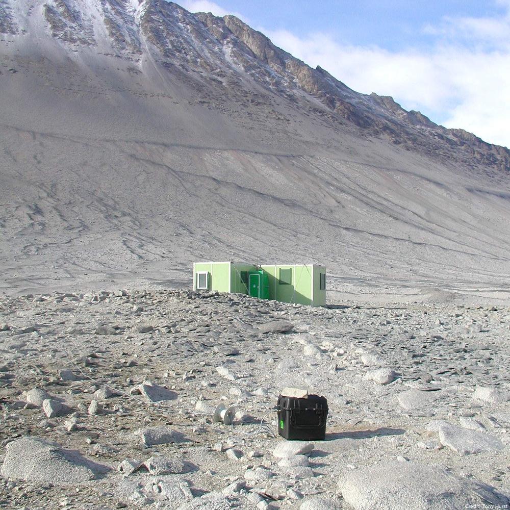
Geomagnetic measurements were established in Antarctica in 1957 as part of the International Geophysical Year and have continued until present. Geomagnetic data have been recorded continuously but for a gap in the data from 1959 until 1963. Since 1963, the components of the Earth’s magnetic field (H, D & Z) and the large variations in this field associated with the arriving charged particles which produce magnetic storms and aurora, have in principle been recorded continuously, with the quality improving as various upgrades were done. The instruments are still located at Scott Base. Because the surface volcanic rocks at Scott Base are strongly magnetised, two other sites are used for repeat measurements of the Earth's magnetic field - Cape Evans (first measured by Scott’s expedition in 1911) and Lake Vanda (first measured in 1974). The magnetic field is remeasured at these sites approximately every five years. This research project forms part of a global network of observatory magnetometers which provide information for the variation of the Earth's geomagnetic field on global and regional scales. Three component recordings of geomagnetic field variations are made, analysed and transmitted to international databases and individual researchers as appropriate. In the 2011/2012 season, we recorded the magnetic field at the Weir site by Lake Vanda, but the site at Astro A is now inaccessible and probably underwater, because the lake level has risen. We established a backup site called C Granite, slightly north-east of Weir, and on the same side of the Onyx River as the refuge huts. In the 2016/17 season, we recorded the magnetic field and took absolute magnetic measurements at the Vanda Weir & Vanda Granite sites over a four-day time period. We also conducted a set of absolute magnetic measurements at the repeat magnetic measurement site at the Cape Evans Magnetic Hut. In the 2022/2023 season, we took absolute magnetic measurements at the Weir and Granite sites at Lake Vanda. In the 2023/2024 season, we took absolute magnetic measurements at the Cape Evans Magnetic Hut. GET DATA Lake Vanda, Cape Evans, Vanda Weir, Vanda Granite, Astro A, Minna Bluff (and other historic measurements from various sites): https://geomag.bgs.ac.uk/data_service/data/surveydata.shtml GET DATA Scott Base (Preliminary and Definitive data): https://imag-data.bgs.ac.uk/GIN_V1/GINForms2?observatoryIagaCode=SBA GET DATA Scott Base Repeat Measurements Dataset from 2009-Present: contact geomag@gns.cri.nz
-
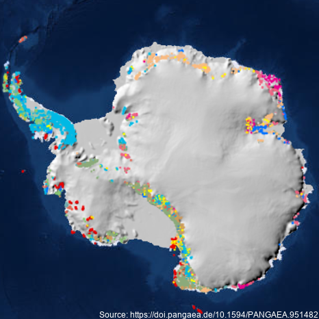
A dataset describing exposed bedrock and surficial geology of Antarctica constructed by the GeoMAP Action Group of SCAR (The Scientific Committee on Antarctic Research) and GNS Science, New Zealand. Legacy geological map data have been captured into a geographic information system (GIS), refining its spatial reliability, harmonising classification, then improving representation of glacial sequences and geomorphology. A total 99,080 polygons have been unified for depicting geology at 1:250,000 scale, but locally there are some areas with higher spatial precision. Geological definition in GeoMAP v.2022-08 is founded on a mixed chronostratigraphic- and lithostratigraphic-based classification. Description of rock and moraine polygons employs international GeoSciML data protocols to provide attribute-rich and queriable data; including bibliographic links to 589 source maps and scientific literature. Data are provided under CC-BY License as zipped ArcGIS geodatabase, QGIS geopackage or GoogleEarth kmz files. GeoMAP is the first detailed geological dataset covering all of Antarctica. GeoMAP depicts 'known geology' of rock exposures rather than 'interpreted' sub-ice features and is suitable for continent-wide perspectives and cross-discipline interrogation. Further details are provided at: Cox, S.C., Smith Lyttle, B., Elkind, S. et al. A continent-wide detailed geological map dataset of Antarctica. Sci Data 10, 250 (2023). https://doi.org/10.1038/s41597-023-02152-9 GET DATA: https://doi.pangaea.de/10.1594/PANGAEA.951482
-
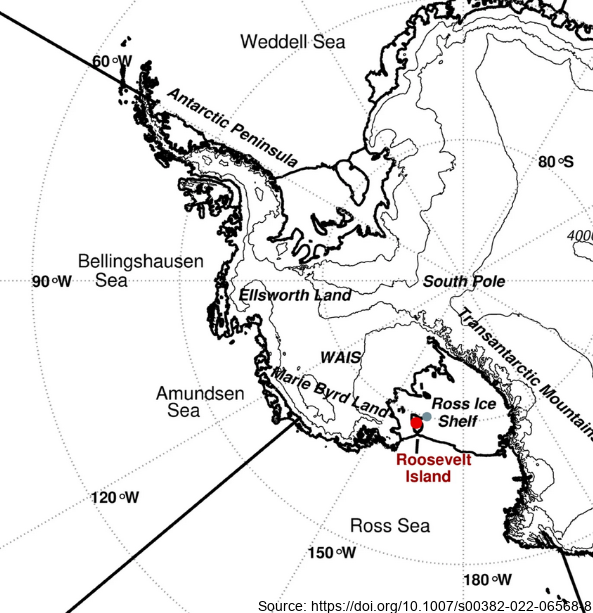
Here we examine the water stable-isotope data from the Roosevelt Island Climate Evolution (RICE) ice core. In this study, we use empirical orthogonal function (EOF) analysis to investigate the relationship between RICE ice-core oxygen-18 isotopes (δ18O) and Southern Hemisphere atmospheric circulation during the extended austral winter (April–November). - Deep Location: 79.364°S, 161.706°W, elevation 550 m a.s.l. - 12/13B Location: 79.362°S, 161.698°W, elevation 550 m a.s.l. - Core depth 763 m. Depth interval provided here: 1.29 to 38.56 m - txt data file, NaN = no data Further details are available at https://doi.org/10.1007/s00382-022-06568-8 GET DATA: https://github.com/demanuelsson/ClimDyn_2022_Matlab/tree/main/data