 GeoData.NZ
Figshare
Type of resources
Available actions
Topics
Keywords
Contact for the resource
Provided by
Years
Update frequencies
status
-
Here, we present a decadally resolved record of sea-salt sodium (a proxy for open-ocean area) and non-sea salt calcium (a proxy for continental dust) from the well-dated Roosevelt Island Climate Evolution (RICE) core, focusing on the time period between 40–26 ka BP. Drilling site coordinates: (79.364° S, 161.706°W). Further collection details can be found at https://doi.org/10.1038/s41467-023-40951-1
-
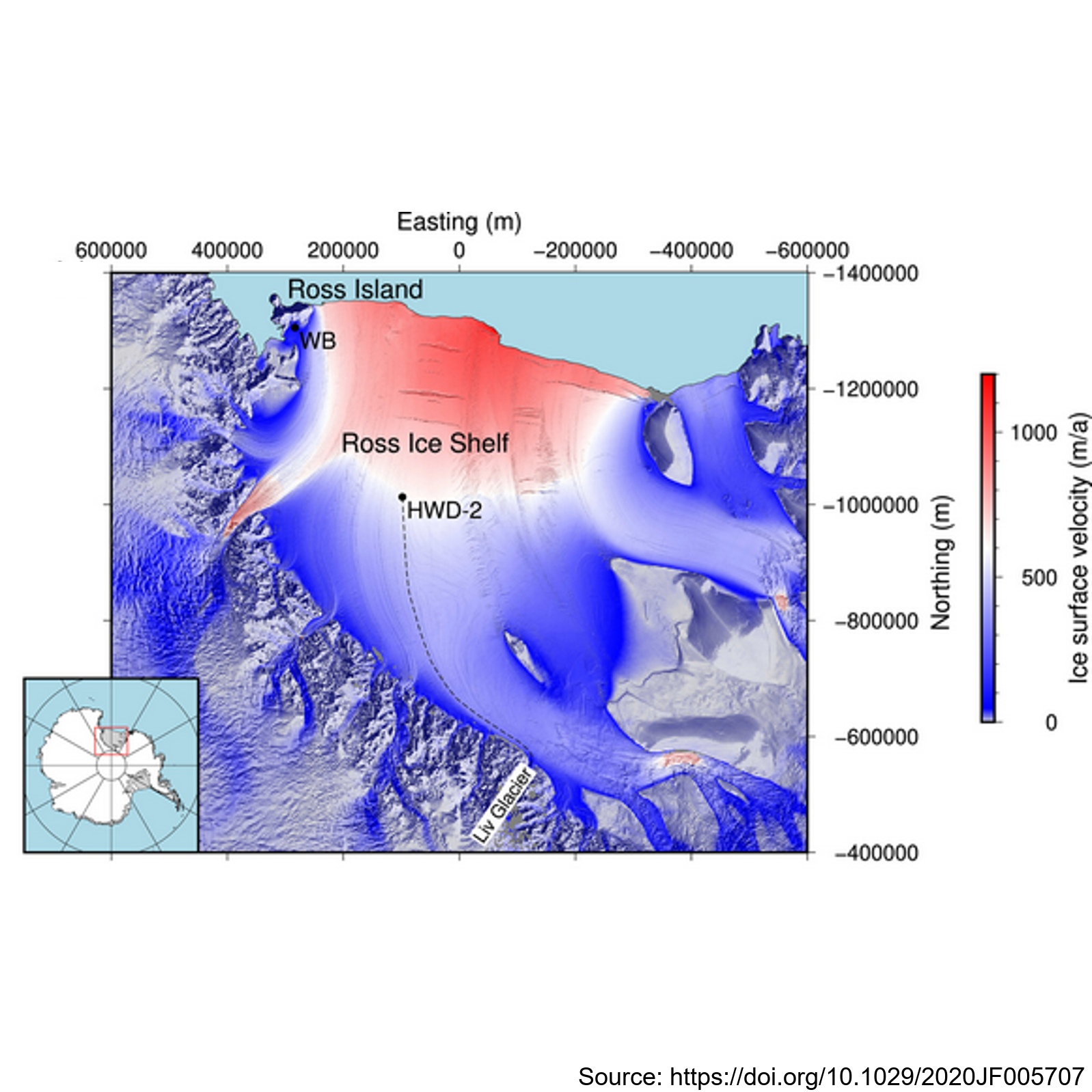
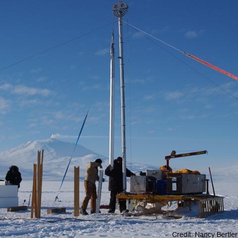
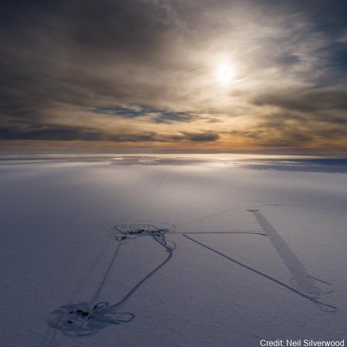
This metadata record presents observations of ice shelf anisotropy derived from borehole seismic data. Hot-water-drilled boreholes were created at two sites: Windless Bight (WB) near the grounding line on Ross Island and HWD-2 in the central Ross Ice Shelf. The boreholes housed seismometers frozen at various depths within the ice, enabling seismic observations of shear wave splitting (SWS) using active seismic sources. At Windless Blight, borehole seismometers were installed at depths of 40 and 190 meters within the ∼220 m thick ice shelf during the 2016/2017 Antarctic field season. Seismic shots were recorded with a 2,000 Hz sampling rate and a 2 s record length, triggered by striking plates. The site was revisited in December 2017 to validate sensor survivability and reproduce survey geometry for SWS analysis using multiazimuth shots. At HWD-2, eight seismometers were deployed at depths ranging from 80 to 325 meters inside the ∼370 m thick ice shelf during the 2017/2018 field season. A total of 747 shots at 53 different shot points were recorded, with clear observations of split shear waves in the data. The study contributes valuable seismic data and methodology for understanding ice shelf anisotropy, enhancing our knowledge of Antarctic ice dynamics and seismic behavior. Further details are provided at: Lutz, F., Eccles, J., Prior, D. J., Craw, L.,Fan, S., Hulbe, C., et al. (2020). Constraining ice shelf anisotropy using shear wave splitting measurements from active‐source borehole seismics.Journal of Geophysical Research: EarthSurface,125, e2020JF005707. https://doi.org/10.1029/2020JF005707 GET DATA: https://auckland.figshare.com/s/9f783802272b825d7ad7
-
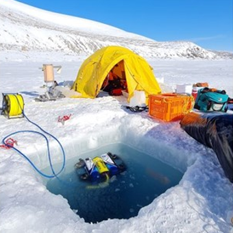
This metadata record represents the data for generated by mining single-cell genomic, transcriptomic, and metagenomic data to uncover the viral diversity, biogeography, activity, and their role as metabolic facilitators of microbes beneath the Ross Ice Shelf. Hot drilling and seawater sampling was conducted from the sub-shelf water column in the central region of the RIS (Latitude −80.6577 N, Longitude 174.4626 W). The sampling site was located ≈300 km from the shelf front. A borehole (30 cm diameter) conducted by hot water drilling was used for direct sampling of seawater from three depths (400 m, 550 m, and 700 m from the top of the shelf, which correspond to 30 m, 180 m, and 330 m from the bottom of the ice shelf, respectively). Seawater samples were processed accordingly for single cell genomics, metagenomics, and transcriptomics as described5, and the resulting assembled and co-assembled contigs (min. length 1 kb) from single-amplified genomes, bins and transcriptomics were mined for detecting viral contigs. Further details are provided at https://doi.org/10.1038/s41467-023-44028-x GET DATA: https://doi.org/10.6084/m9.figshare.24581331
-
This metadata record represents environmental DNA sequence data and metadata barcode file. Seawater and sponge eDNA metabarcoding sampling was conducted at seven coastal locations (Cape Barne, Cape Evans, Cziko Seamount, Granite Harbor Middle, Granite Harbor South, and Turtle Rock) in the Ross Sea to assess spatial eukaryote biodiversity patterns and investigate eDNA signal differences between both substrates. Five replicate 500 mL water samples were collected at each of seven locations within 2 m of the ocean floor using a Niskin bottle. At the same time, five sponge specimens were collected by ROV at a depth range of 18–30 m from three out of the seven locations, thereby enabling sponge and near-bottom water eDNA signal comparison. Further details and laboratory procedures can be found in https://doi.org/10.1002/edn3.500 GET DATA: https://figshare.com/projects/Unveiling_the_Hidden_Diversity_of_Marine_Eukaryotes_in_the_Ross_Sea_A_Comparative_Analysis_of_Seawater_and_Sponge_eDNA_Surveys/186127
-
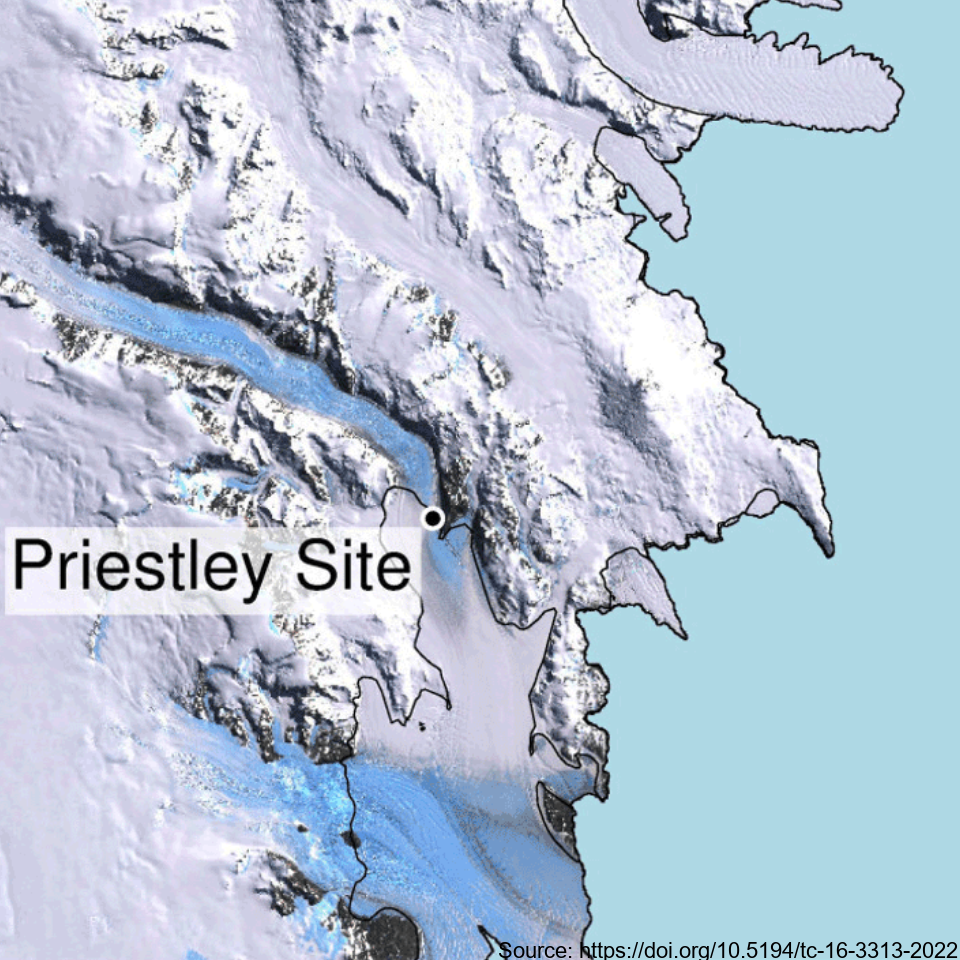
This metadata record represents the first direct comparison of seismic and ultrasonic data with measured crystallographic preferred orientations Crystallographic preferred orientations (CPO) in a polar shear margin (Priestly Glacier, Antarctica). Analyses of seismic, ultrasonic and measured CPO datasets were combined to assess the potential of active-source seismic surveys for the constraint of shear margin anisotropy, which provide an assessment of ice flow dynamics and stability. A continuous ice core of 58 m length was drilled and recovered in December 2019 and January 2020 in a lateral shear margin of the Priestley Glacier, located in Victoria Land, Antarctica. Core samples were analysed for CPO using electron backscatter diffraction (EBSD) measurements. The core orientation was carefully preserved during drilling, which enabled azimuthal orientation of the CPO. To complete the link between seismic anisotropy of the ice volume around the borehole and CPO measurements from the core, multi-azimuthal ultrasonic velocity measurements were made on core samples in the laboratory. The vertical-seismic-profile (VSP) dataset was recorded at the Priestley drill site using a three-component borehole seismometer to investigate seismic properties and anisotropy within the glacier ice. Additionally, multi-azimuthal ultrasonic velocity measurements were conducted on core samples in the laboratory, complementing the seismic data analysis. Further details are provided at: Lutz, F., Prior, D.J., Still, H., Hamish Bowman, M., Boucinhas, B., Craw, L., Fan, S., Kim, D., Mulvaney, R., Thomas, R.E., & Hulbe, C.L. (2022). Ultrasonic and seismic constraints on crystallographic preferred orientations of the Priestley Glacier shear margin, Antarctica. *Cryosphere*, 16(8), 3313-3329. https://doi.org/10.5194/tc-16-3313-2022 GET DATA: https://auckland.figshare.com/articles/dataset/Priestley_Glacier_seismic_and_ultrasonic_constraints_on_crystallographic_orientation/17108639