 GeoData.NZ
LABORATORY
Type of resources
Available actions
Topics
Keywords
Contact for the resource
Provided by
Years
Update frequencies
status
-
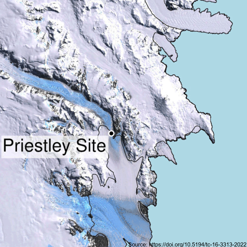
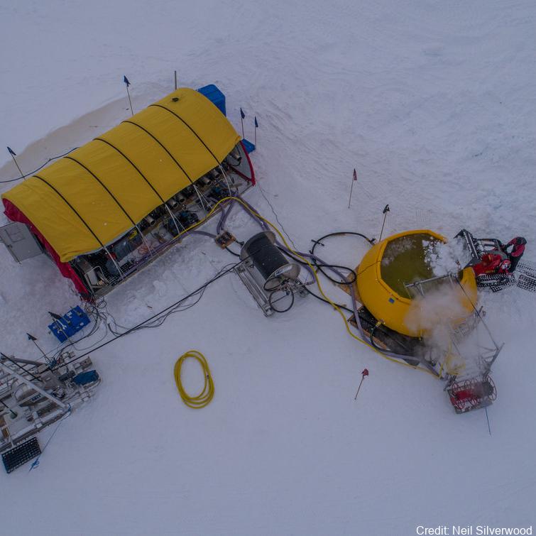
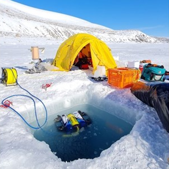
This metadata record represents the first direct comparison of seismic and ultrasonic data with measured crystallographic preferred orientations Crystallographic preferred orientations (CPO) in a polar shear margin (Priestly Glacier, Antarctica). Analyses of seismic, ultrasonic and measured CPO datasets were combined to assess the potential of active-source seismic surveys for the constraint of shear margin anisotropy, which provide an assessment of ice flow dynamics and stability. A continuous ice core of 58 m length was drilled and recovered in December 2019 and January 2020 in a lateral shear margin of the Priestley Glacier, located in Victoria Land, Antarctica. Core samples were analysed for CPO using electron backscatter diffraction (EBSD) measurements. The core orientation was carefully preserved during drilling, which enabled azimuthal orientation of the CPO. To complete the link between seismic anisotropy of the ice volume around the borehole and CPO measurements from the core, multi-azimuthal ultrasonic velocity measurements were made on core samples in the laboratory. The vertical-seismic-profile (VSP) dataset was recorded at the Priestley drill site using a three-component borehole seismometer to investigate seismic properties and anisotropy within the glacier ice. Additionally, multi-azimuthal ultrasonic velocity measurements were conducted on core samples in the laboratory, complementing the seismic data analysis. Further details are provided at: Lutz, F., Prior, D.J., Still, H., Hamish Bowman, M., Boucinhas, B., Craw, L., Fan, S., Kim, D., Mulvaney, R., Thomas, R.E., & Hulbe, C.L. (2022). Ultrasonic and seismic constraints on crystallographic preferred orientations of the Priestley Glacier shear margin, Antarctica. *Cryosphere*, 16(8), 3313-3329. https://doi.org/10.5194/tc-16-3313-2022 GET DATA: https://auckland.figshare.com/articles/dataset/Priestley_Glacier_seismic_and_ultrasonic_constraints_on_crystallographic_orientation/17108639
-
In Antarctica, ice shelves such as the Ross Ice Shelf (RIS) fringe 75% of the coastline and cover over 1.5 million km2, creating distinct and largely unexplored marine environments. It is fundamental to characterize the communities under these shelves to understand their biogeochemical role and predict how they might respond to future ice-shelf collapse 1,2. While historical studies suggested the RIS harbors active microorganisms 3–5, nothing is known about the composition of these communities. In this study, we profiled the composition, function, and activities of microbial communities in three seawater samples (400, 550, 700 m depth) underlying the shelf interior. We combined rate measurements with multi-omics (i.e. single-cell genomics, metagenomics, metatranscriptomics, and metaproteomics). Overall, below-shelf waters harbour microbial communities of comparable abundance and diversity to deep pelagic waters. Based on the meta-omic data, the community is inferred to be sustained by dark carbon fixation using ammonia, nitrite, and sulfur compounds as electron donors. In turn, these chemolithoautotrophs are predicted to support the aerobic heterotrophic majority and various trophic interactions. Consistently, this study and previous activity measurements suggest that dark carbon fixation is sufficient to sustain prokaryotic heterotrophic production, making the waters below the RIS presumably the largest chemolithotrophic system in the global ocean. Further details are provided at https://doi.org/10.1038/s41467-021-27769-5 GET DATA: https://www.ebi.ac.uk/ena/browser/view/PRJEB35712 GET DATA: https://www.ncbi.nlm.nih.gov/bioproject/?term=PRJNA593264
-
This metadata record represents environmental DNA sequence data and metadata barcode file. Seawater and sponge eDNA metabarcoding sampling was conducted at seven coastal locations (Cape Barne, Cape Evans, Cziko Seamount, Granite Harbor Middle, Granite Harbor South, and Turtle Rock) in the Ross Sea to assess spatial eukaryote biodiversity patterns and investigate eDNA signal differences between both substrates. Five replicate 500 mL water samples were collected at each of seven locations within 2 m of the ocean floor using a Niskin bottle. At the same time, five sponge specimens were collected by ROV at a depth range of 18–30 m from three out of the seven locations, thereby enabling sponge and near-bottom water eDNA signal comparison. Further details and laboratory procedures can be found in https://doi.org/10.1002/edn3.500 GET DATA: https://figshare.com/projects/Unveiling_the_Hidden_Diversity_of_Marine_Eukaryotes_in_the_Ross_Sea_A_Comparative_Analysis_of_Seawater_and_Sponge_eDNA_Surveys/186127
-
The New Zealand Terrestrial Antarctic Biocomplexity Survey (nzTABS) is the largest and most comprehensive interdisciplinary landscape-scale study of terrestrial biology ever undertaken in Antarctica, incorporating fieldwork of 1500+ person days in 6 of the Dry Valleys (total area of 6500 km2), strategic sampling of over 1200 sites designed to encompass the landscape heterogeneities in the ecosystem, and a range of high-resolution remote sensing data. All samples were collected during the month of January in each sampling year. Initially a 220 km2 study area, consisting of Miers, Marshall, and Garwood Valleys as well as Shangri-La, was divided into more than 600 geographically and geologically distinct ice-free sectors (hereinafter “tiles”) using remote-sensing data and published soil maps. Tile boundaries were delineated where the combination of geographical and geological variables changed, and on-the-ground assessments were carried out in November 2008 to confirm the reliability of delineations. 554 tiles were chosen for sampling to encompass the entire range of geographical and geological heterogeneity. Sampling of soils and biological communities was carried out over two successive austral summers (January 2009 and January 2010). Surveys were conducted for vegetation (i.e., mosses, lichens, algal and cyanobacterial mats), lithic microbial communities, and invertebrates at each sampling site (verified by GPS to be inside its respective tile), followed by collection of bulk soil samples for additional analyses, including molecular analyses of bacteria (total and cyanobacteria-only) and fungi. In addition, a number of key variables were derived from satellite imagery, including surface soil temperature, a topographically derived ‘wetness index’, and distance to the coast. After quality control, data for 490 samples were included in the analysis. These data represent geochemistry and geomorphology to population genetics and microbial ecology parameters. Further details are provided at https://doi.org/10.1038/s42003-018-0274-5. Please cite the data with the following citation: Lee, C.K., Laughlin, D.C., Bottos, E.M. et al. Biotic interactions are an unexpected yet critical control on the complexity of an abiotically driven polar ecosystem. Commun Biol 2, 62 (2019). https://doi.org/10.1038/s42003-018-0274-5