ADCP
Type of resources
Topics
Keywords
Contact for the resource
Provided by
Years
status
-

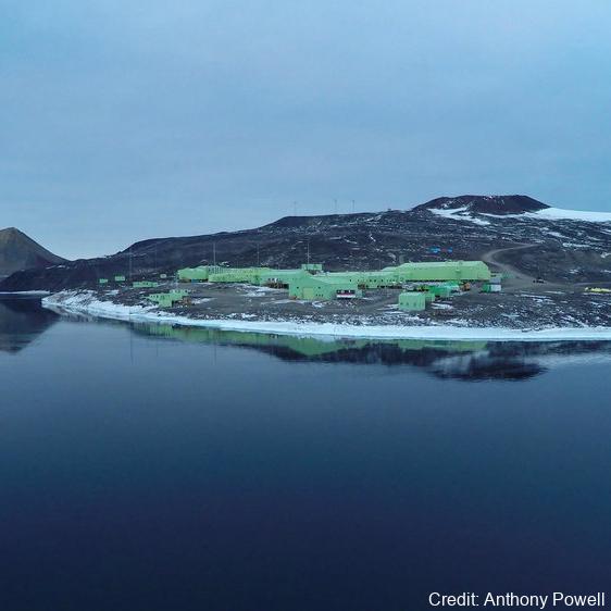
As part of the Scott Base Redevelopment Marine Monitoring Programme, the impact of Scott Base's activities on the local marine environment was assessed. Sampling took place at three sites around Hut Point Peninsula on the southern half of Ross Island during October – November 2019 to assess anthropogenic contamination. Two acoustic doppler current profilers (ADCP; Nortek Signature 500) were deployed, and set with a 2-minute sampling period in 1m vertical depth bins from the seabed to the underside of the ice. Instrument heads were kept ~0.5 m beneath the under-surface. ADCP data were downloaded, extracted from their raw formats, and averaged into 10-minute intervals. A magnetic declination of 141.09° E was applied to the measured current direction to correct the readings to reflect true north and a pressure offset was applied to standardise depths relative to ambient air pressure at the seawater surface. Information on habitats and benthic epifauna assemblage composition were collected using high resolution video across 2 25m transects at ~22m depth. Multiple overlapping passes were made across the seabed transects at ~0.5 m depth contours between ~20 – 26 m in order to create a 2D orthomosaic image of each site. Analysis of the diver-collected video was done using individual frames. The video along each transect was divided into 10 equal time segments and still frames were taken at random from the first, third, fifth, seventh and ninth segments. Eight video frames were analysed per transect (i.e., n=8 per transect and n=16 per site) by one individual to minimise observer bias. Sediment samples were collected by divers to determine contaminant concentrations and sediment characteristics (sediment particle size composition, organic matter content, organic carbon content and algal pigment content) at each site. Sponge species (Sphaerotylus antarcticus and Laternula elliptica) were collected for tissue contaminant analysis. Full description of methods is available at: https://doi.org/10.1007/s00300-023-03181-1 GET DATA: drew.lohrer@niwa.co.nz
-

This work was primarily funded by the NASA-funded RISE-UP: Ross Ice Shelf & Europa Underwater Probe (PI Britney E. Schmidt) project. Field work at the KIS-1 site during the 2019-2020 season was completed through international collaboration between NASA, NSF/USAP, and Antarctica New Zealand, funded by the Aotearoa New Zealand Antarctic Science Platform (ANTA1801) Antarctic Ice Dynamics Project (ASP02101), and the NZARI-funded Aotearoa New Zealand Ross Ice Shelf Programme, “Vulnerability of the Ross Ice Shelf in a Warming World” (grant no. 2014-11). The data contained in this directory are merged and calibrated data files from three missions conducted with ROV Icefin through a borehole drilled through Ross Ice Shelf at KIS1 (-82.78410, -155.26267), near the Kamb Ice Stream grounding zone. Missions were conducted in 2019 on December 16th, 18th, and 21st (UTC). For questions or assistance working with the data please contact Britney Schmidt (britneys@cornell.edu) and Justin Lawrence (jdl287@cornell.edu). Related Publication: https://doi.org/10.1038/s41561-023-01129-y GET DATA: https://doi.org/10.15784/601625
-

Contained in this folder are the raw and processed data files for data collected with the underwater robot Icefin in the ocean cavity beneath Ross Ice Shelf, near the grounding line of Kamb Ice Stream. Most of these data are located within a basal crevasse. They were collected in December 2019 as part of the Aotearoa New Zealand Antarctic Science Platform and Victoria University of Wellington Hot Water Drilling initiative, and the NASA RISEUP grant (NNX16AL07G, PI B. E. Schmidt). The code that converted raw data files to processed can be found at https://zenodo.org/record/8338529. Direct questions to Peter Washam at pwasham@cornell.edu. RELATED PUBLICATION: https://doi.org/10.1126/sciadv.adi7638 GET DATA: https://doi.org/10.15784/601733
 GeoData.NZ