 GeoData.NZ
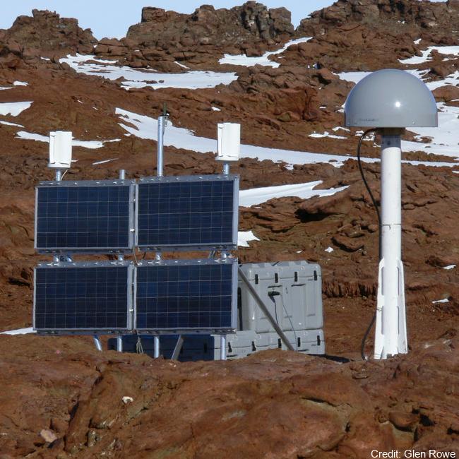
Continuous GNSS Observations from Antarctica: Scott Base, Butcher Ridge, Minna Bluff, Cape Roberts
The network collects Global Navigation Satellite System (GNSS) data for the purposes of monitoring the New Zealand Geodetic Datum 2000 (NZGD2000), updating the national deformation model, and maintaining New Zealand’s relationship to the International Terrestrial Reference Frame (ITRF). Antarctic GNSS data form part of the New Zealand campaign GNSS (Global Navigation Satellite System) surveys.
Data have been collected by periodic campaign style GNSS surveys.
High accuracy continuous Global Positioning System tracking stations in Antarctica:
- Scott Base (SCTB - LINZ Geodetic Code) and was operational as of 29 October 2004.
- Butcher Ridge (BURI- LINZ Geodetic Code) on 7 December 2007.
- Minna Bluff (MIN0- LINZ Geodetic Code) on 31 January 2007.
- Cape Roberts (ROB4- LINZ Geodetic Code) on 29 November 2005.
Data are available in Receiver Independent Exchange Format (RINEX) files at 30 or 15 seconds sampling rate.
GET DATA: https://www.geodesy.linz.govt.nz/positionz/?page=text
GET DATA: https://www.linz.govt.nz/products-services/geodetic/positionz/positionz-real-time-service
Simple
- Date (Creation)
- 2023-08-17T10:32:33
- Date (Publication)
- 2023-08-17T10:32:38
Identifier
- Identifier
- https://doi.org/10.21420/4CWA-QH61
- Status
- onGoing On going
- Maintenance and update frequency
- As needed
- Date of next update
- 2023-08-17T10:32:42
- Keywords
-
- K150A
- GCMD Earth Science and Earth Science Services Keywords
-
- CONTROL SURVEYS
- CRUSTAL MOTION
- GCMD Platform/Sources Keywords
-
- GROUND STATIONS
- GCMD Instrument/Sensors Keywords
-
- GPS
- GNSS RECEIVER
- GNSS
- GCMD Locations Keywords
-
- ANTARCTICA
- Use limitation
- This data set conforms to the CC BY Attribution License (https://creativecommons.org/licenses/by/4.0/)
- Hierarchy level
- Dataset
- Date
- Statement
- Creative Commons Attribution 4
- gmd:disseminationConstraints
- License
- Access constraints
- License
- Use constraints
- License
- Metadata language
- English
- Character set
- utf8 UTF8
- Topic category
-
- Geoscientific information
))
- Begin date
- 2004-10-29T00:00:00
- Distribution format
-
- File identifier
- f1f352eb-e3d2-4d13-bbf4-f1acbfdc7fee XML
- Metadata language
- English
- Character set
- anyValidURI
- Hierarchy level
- Dataset
- Date stamp
- 2023-12-19T02:11:26
- Metadata standard name
- ISO 19115-1
- Metadata standard version
- 2018
Overviews
Spatial extent
Provided by
