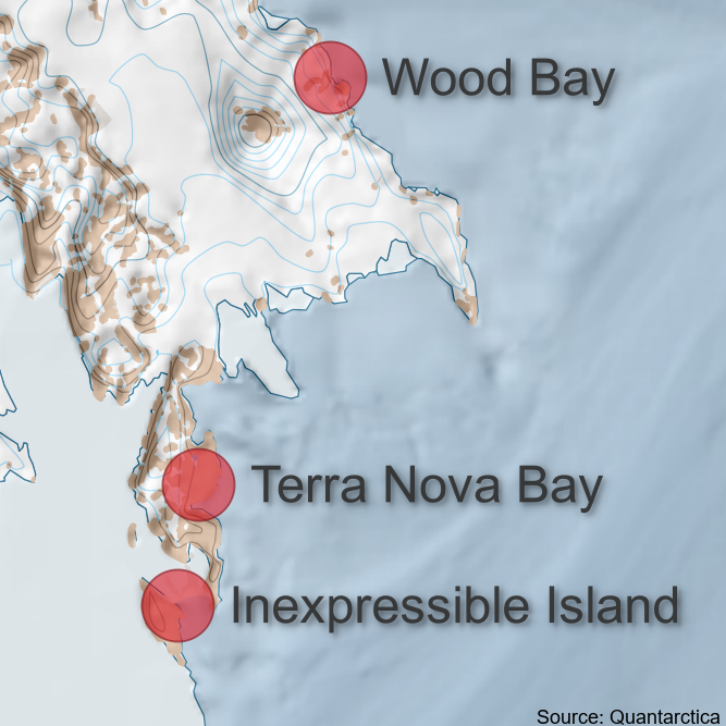
Adelie Penguin Census Locations, Ross Island and Victoria Land Coast, 1981-Present
The Antarctica New Zealand Adelie Penguin Census Survey takes aerial images with a helicopter of known penguin colonies on Ross Island and across the Victoria Land coastline. These files provide 36 adelie colony locations.
The KML and GeoPackage files both include the same 36 colony locations. Note: colony coordinates are missing for Chinstrap Island, Franklin Island East, and Thala Island.
Geopackage and KML files were created in QGIS, and the coordinates were later used to create the GeoPDF files which were used for helicopter navigation to the Adelie penguin colonies.
Simple
- Date (Creation)
- 2024-03-07T12:31:26
- Date (Publication)
- 2024-03-07T12:31:27
Citation identifier
- Purpose
-
To assist with Adelie and Emperor penguin colony navigation
- Status
- On going
- Point of contact
-
Organisation name Individual name Electronic mail address Role Meredyth-Young, M.
Author Antarctica New Zealand
Publisher
- Maintenance and update frequency
- As needed
- Date of next update
- 2024-03-07T12:31:30
- Keywords
-
-
VICTORIA LAND
-
PENGUIN CENSUS
-
K850A
-
- GCMD Earth Science and Earth Science Services Keywords
-
-
PENGUINS
-
GEOLOCATION
-
- GCMD Locations Keywords
-
-
ANTARCTICA
-
ROSS ISLAND
-
ROSS SEA
-
- Use limitation
-
This data set conforms to the CC BY Attribution License ( https://creativecommons.org/licenses/by/4.0/ )
- Hierarchy level
- Dataset
- Date
- Statement
-
Creative Commons Attribution 4
- gmd:disseminationConstraints
- License
- Access constraints
- License
- Use constraints
- License
- Aggregate Datasetindentifier
- f6514f79-d113-44de-b15c-87dc44cba28e
- Association Type
- Cross reference
- Initiative Type
- Project
- Aggregate Datasetindentifier
- 0e41904f-bbf3-4431-a551-79f4452302f5
- Association Type
- Cross reference
- Initiative Type
- Project
- Aggregate Datasetindentifier
- 6f64a11c-8b19-401c-87da-feaa0dc3bc13
- Association Type
- Cross reference
- Initiative Type
- Project
- Language
- English
- Character set
- UTF8
- Topic category
-
- Biota
))
- Begin date
- 2023-01-01T00:00:00
- End date
- 2023-11-01
- Reference system identifier
- EPSG / 3031
- Distribution format
-
Name Version
- OnLine resource
-
Protocol Linkage Name WWW:DOWNLOAD-1.0-http--download
https://antcat.antarcticanz.govt.nz:/geonetwork/srv/api/records/e9ffba18-aa2c-405e-adc2-f49f8f51728a/attachments/adelie_census_colony_locations.kml KML
WWW:DOWNLOAD-1.0-http--download
https://antcat.antarcticanz.govt.nz:/geonetwork/srv/api/records/e9ffba18-aa2c-405e-adc2-f49f8f51728a/attachments/adelie_census_colony_locations.gpkg GeoPackage
- Hierarchy level
- Dataset
- Statement
-
GeoPackage and KML files include the point locations of Adelie penguin census locations surveyed in the 2023/24 season.
Metadata
- File identifier
- e9ffba18-aa2c-405e-adc2-f49f8f51728a XML
- Metadata language
- English
- Character set
- anyValidURI
- Hierarchy level
- Dataset
- Date stamp
- 2024-07-17T11:05:41.048Z
- Metadata standard name
-
ISO 19115
- Metadata standard version
-
2003
- Metadata author
-
Organisation name Individual name Electronic mail address Role Antarctica New Zealand
Point of contact