 GeoData.NZ
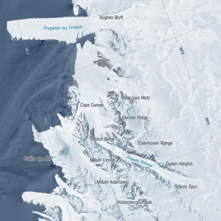
GNSS Data collected at Priestley Glacier November 2018
This is GNSS data of four stations covering the grounding zone of Priestley Glacier Antarctica.
Tidal modulation of ice streams and their adjacent ice shelves is a real-world experiment to understand ice-dynamic processes. We observe the dynamics of Priestley Glacier, Antarctica, using Terrestrial Radar Interferometry (TRI) and GNSS. Ocean tides are predominantly diurnal but horizontal GNSS displacements oscillate also semi-diurnally. The oscillations are strongest in the ice shelf and tidal signatures decay near-linearly in the TRI data over >10 km upstream of the grounding line. Tidal flexing is observed >6 km upstream of the grounding line including cm-scale uplift. Tidal grounding line migration is small and <40 % of the ice thickness. The frequency doubling of horizontal displacements relative to the ocean tides is consistent with variable ice-shelf buttressing demonstrated with a visco-elastic Maxwell model. Taken together, this supports previously hypothesized flexural ice softening in the grounding-zone through tides and offers new observational constraints for the role of ice rheology in ice-shelf buttressing.
Related Publication:
Drews, R., Wild, C. T., Marsh, O. J., Rack, W., Ehlers, T. A., Neckel, N., & Helm, V. (2021). Grounding-zone flow variability of Priestley Glacier, Antarctica, in a diurnal tidal regime. Geophysical Research Letters, 48, e2021GL093853. https://doi.org/10.1029/2021GL093853
GET DATA:
Simple
- Date (Creation)
- 2021-09-22T00:00:00
- Date (Publication)
- 2021-09-22T00:00:00
Identifier
- Identifier
- https://doi.org/10.1594/PANGAEA.936090
- Status
- completed Completed
- Maintenance and update frequency
- Not planned
- Keywords
-
- PRIESTLEY GLACIER
- GCMD Earth Science and Earth Science Services Keywords
-
- TIDES
- GLACIERS
- GLACIER MOTION/ICE SHEET MOTION
- OCEANS
- GCMD Platform/Sources Keywords
-
- Global Positioning System (GPS)
- GCMD Instrument/Sensors Keywords
-
- GPS
- GNSS
- GCMD Locations Keywords
-
- ANTARCTICA
- Use limitation
- This data set conforms to the CC BY Attribution License (https://creativecommons.org/licenses/by/4.0/)
- Hierarchy level
- Dataset
- Date
- Statement
- Creative Commons Attribution 4
- gmd:disseminationConstraints
- License
- Access constraints
- License
- Use constraints
- License
- Metadata language
- English
- Character set
- utf8 UTF8
- Topic category
-
- Geoscientific information
))
- Begin date
- 2018-11-01T00:00:00
- End date
- 2018-12-29T12:00:00
- Distribution format
-
Overviews
Spatial extent
Provided by
