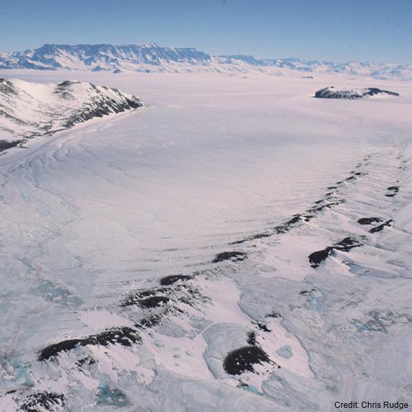
Coastal and Landfast Sea Ice Thickness in Western Ross Sea, Antarctica, from Airborne Electromagnetic Induction in November 2017: Sea Ice in Front of Hells Gate Ice Shelf
The data are approximately 800 km of airborne electromagnetic survey of coastal sea ice and sub-ice platelet layer (SIPL) thickness distributions in the western Ross Sea, Antarctica, from McMurdo Sound to Cape Adare. Data were collected between 8 and 13 November 2017, within 30 days of the maximum fast ice extent in this region. Approximately 700 km of the transect was over landfast sea ice that had been mechanically attached to the coast for at least 15 days. Most of the ice was first-year sea ice. Unsmoothed in-phase and quadrature components are presented at all locations. Data have been smoothed with an 100 point median filter, and in-phase and quadrature smoothed data are also presented at all locations. Beneath level ice it is possible to identify the thickness of an SIPL and a filter is described (Langhorne et al) to identify level ice. Level ice in-phase, quadrature and SIPL thickness, derived from these, are presented at locations of level ice. For rough ice, the in-phase component is considered the best measure of sea ice thickness. For level ice where there is the possibility of an SIPL, then the quadrature component is considered the best measure of ice thickness, along with SIPL thickness. All data are in meters.
Simple
Identification info
- Date (Creation)
- 2022-11-09T10:58:00
- Date (Publication)
- 2022-11-09T10:43:00
- Citation identifier
- https://doi.org/10.1594/PANGAEA.950398
- Presentation form
- Status
- Completed
- Point of contact
-
Role Organisation Electronic mail address Author Co-author Co-author Co-author Co-author Co-author Publisher PANGAEA
- Spatial representation type
- Topic category
-
- Oceans
Extent
))
Temporal extent
- Time period
- 2017-11-09T00:00:00 2017-11-09T00:00:00
- Keywords
-
-
SUB-ICE PLATLET LAYER
-
ELECTROMAGNETIC INDUCTION
-
EM-BIRD
-
K066A
-
- GCMD Earth Science and Earth Science Services Keywords
-
-
SEA ICE
-
ICE DEPTH/THICKNESS
-
SEA ICE DYNAMICS
-
- GCMD Platform/Sources Keywords
-
-
Ice Shelf
-
Air-based Platforms
-
HELICOPTER
-
Airplane
-
FIELD SURVEYS
-
- GCMD Locations Keywords
-
-
ROSS SEA
-
ANTARCTICA
-
Resource constraints
- Use limitation
-
This data set conforms to the CC BY Attribution License ( https://creativecommons.org/licenses/by/4.0/ )
- Hierarchy level
- Dataset
- Title
-
Attribution 4.0 International (CC BY 4.0)
- Website
-
Attribution 4.0 International (CC BY 4.0)
Human Readable summary of the CC BY copyright license.
- Statement
-
Creative Commons Attribution 4
- Constraints of dissemination
- License
- Access constraints
- License
- Use constraints
- License
- Language
- English
- Character encoding
- UTF8
Distribution Information
- Distribution format
-
- OnLine resource
-
Pangaea
Metadata constraints
- Use limitation
-
This data set conforms to the CC BY Attribution License ( https://creativecommons.org/licenses/by/4.0/ )
- Hierarchy level
- Metadata
- Title
-
Attribution 4.0 International (CC BY 4.0)
- Website
-
Attribution 4.0 International (CC BY 4.0)
Human Readable summary of the CC BY copyright license.
- Statement
-
Creative Commons Attribution 4
- Constraints of dissemination
- License
- Access constraints
- License
- Use constraints
- License
Metadata
- Metadata identifier
- urn:uuid/742ab8fe-f0c3-4974-a0fa-81f6e8d49eb7
- Language
- English
- Character encoding
- anyValidURI
- Contact
-
Role Organisation Electronic mail address Point of contact Langhorne, Patricia J.
Type of resource
- Resource type
- Dataset
- Date info (Revision)
- 2024-05-23T23:02:42
- Date info (Creation)
- 2024-03-04T20:37:01
Metadata standard
- Title
-
ISO 19115-1
- Edition
-
2018